EARTH SCIENCE • ANTARCTICA • SATELLITE OBSERVATIONS
Iceberg A-81 Reaches South Georgia
A long ocean journey slows at the edge of an island’s underwater shelf.
ADDED OCTOBER 29, 2026 • NASA REPORT OCTOBER 27 • IMAGE OCTOBER 20, 2026
The reported journey
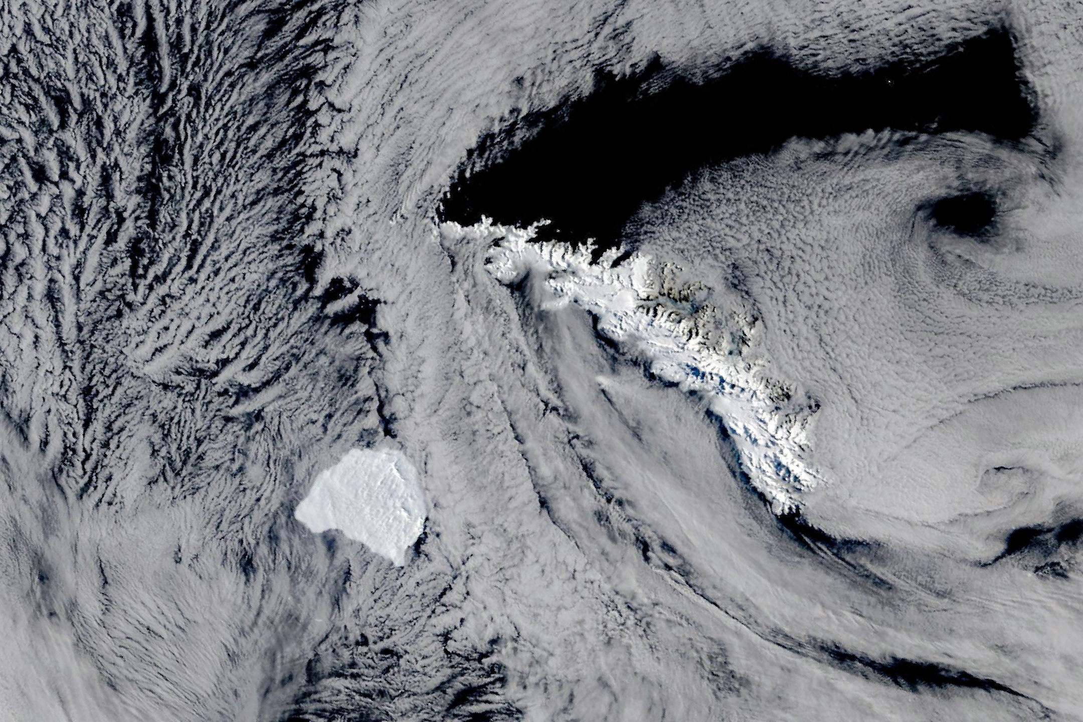
A-81 calved from Antarctica’s Brunt Ice Shelf in January 2023. It spent more than three years in the Weddell Sea, reached the Antarctic Peninsula’s tip by May 2026, then moved north into the Scotia Sea. By late October it approached South Georgia, roughly 2,300 kilometers (1,400 miles) north-northwest of Brunt.
What the satellite report shows
NASA’s Terra/MODIS image records October 20 conditions. NASA reports that the berg’s drift had slowed and that it appeared to bump along the island’s shallow underwater shelf. This is not a declaration of permanent grounding or an observed breakup.
How large is it?
NASA describes the berg as roughly 1,550 square kilometers. A separate Copernicus report cites a mid-October 2026 estimate of about 1,340 square kilometers from the U.S. National Ice Center. Measurements from different dates should be labeled rather than treated as one timeless size.
| Milestone | Date |
|---|---|
| Calving from Brunt | January 2023 |
| Reached peninsula tip | By May 2026 |
| Terra image near South Georgia | October 20, 2026 |
Distance is not the same as route length
MKP interpretation: The reported 2,300 kilometers compares the berg’s location with its origin. Because the route curves through ocean basins, that figure should not be presented as the total distance accumulated along its track.
What happens next?
The cited snapshot does not determine A-81’s future route or breakup date. NASA notes that another large iceberg, A-23A, grounded near South Georgia and later fragmented in 2025; that precedent is context, not a forecast for A-81.
Why it belongs in MKP
MKP perspective: This story brings together moving ice, ocean circulation, seabed geography and remote observation. It is also an example of reading a satellite image carefully: one dated view helps document a position, while movement requires comparison over time.
Discussion prompts
What measurements would distinguish slow drift from grounding? How would you calculate total route length from a sequence of positions? Why might an iceberg’s area estimates differ between dates?
Discuss Earth’s changing ice →Primary sources
- NASA Earth Observatory: A-81 Reaches South Georgia — October 27, 2026.
- EU/Copernicus: Two Antarctic icebergs drift towards South Georgia — October 19, 2026.
This article describes the cited October observations, not a live tracking feed.